Cold Weather Alerts
Freeze Watch vs Warning: How Frost Advisory Fits In
Freeze watch vs warning is mostly a timing and confidence difference: a watch means subfreezing temperatures are possible soon, while a warning means damaging freeze conditions are expected or already underway. Frost advisory sits one step lower, usually when mid-30s temperatures, clear skies, and light winds can still damage sensitive plants during the local growing season.
Freeze watch vs warning matters because the label tells you how quickly you need to act on tender plants, early blooms, and exposed plumbing. If you already use the site's hour-by-hour forecast to time coldest conditions, this guide explains how National Weather Service frost and freeze alerts fit on top of that temperature curve and why the same 33 to 36 degrees F night can produce a frost advisory in one place and no headline in another.
Quick comparison: what the alert tells you
Local criteria can vary| Alert | Typical trigger | Lead time | Main action |
|---|---|---|---|
| Freeze Watch | Subfreezing temperatures are possible during the growing season, often within the next 24 to 48 hours. | Plan and stage | Move portable plants, locate covers, drain hoses, and watch the overnight trend. |
| Freeze Warning | 32 degrees F or lower is expected, though some offices emphasize 29 to 32 degrees F or several hours at or below freezing. | Act now | Cover or move sensitive plants, protect outdoor plumbing, and prepare for damage where vegetation has already leafed out. |
| Frost Advisory | 33 to 36 degrees F with light winds and clear skies during the growing season. | Act before sunset | Cover tender plants and use microclimate protection where radiational cooling is likely. |
The table uses the most common NWS public criteria language, but local offices are allowed to tune frost and freeze thresholds to local climatology and the locally defined growing season.
What is the difference between a freeze watch and a freeze warning?
The practical difference is not that one product refers to a tiny cold snap and the other refers to a major arctic outbreak. It is mainly about certainty and timing. A freeze watch means the ingredients for a freeze are lining up soon enough that you should start planning; a freeze warning means the forecast office has enough confidence that damaging subfreezing temperatures are expected and that unprotected vegetation or exposed plumbing could be hit if you wait.
That distinction matters because the protective work is front-loaded. A watch is when you should decide which patio plants can be moved, whether you need frost cloth, and whether any exposed hose bibs or irrigation parts need attention. A warning is when those decisions should already be done. If you want the broader terminology refresher first, the site's watch, warning, and advisory guide explains the action difference across the whole NWS alert system.
Local criteria pages show how this gets operationalized. NWS Raleigh, for example, describes a freeze watch as conditions favorable in the next 24 to 48 hours for a freeze event to meet warning criteria during the growing season. NWS Charleston, West Virginia similarly explains that a freeze watch may be issued a few days ahead if temperatures could fall into local warning thresholds, while the warning itself is reserved for temperatures expected to reach damaging freeze values during the locally defined growing season. The wording is consistent: watch equals prep window, warning equals execution window.
How does a frost advisory fit in?
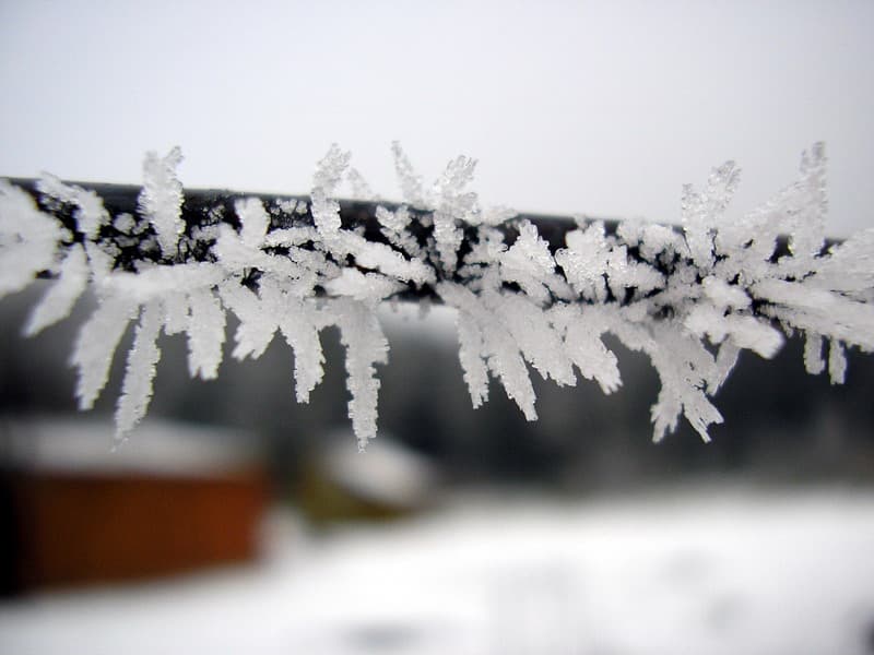
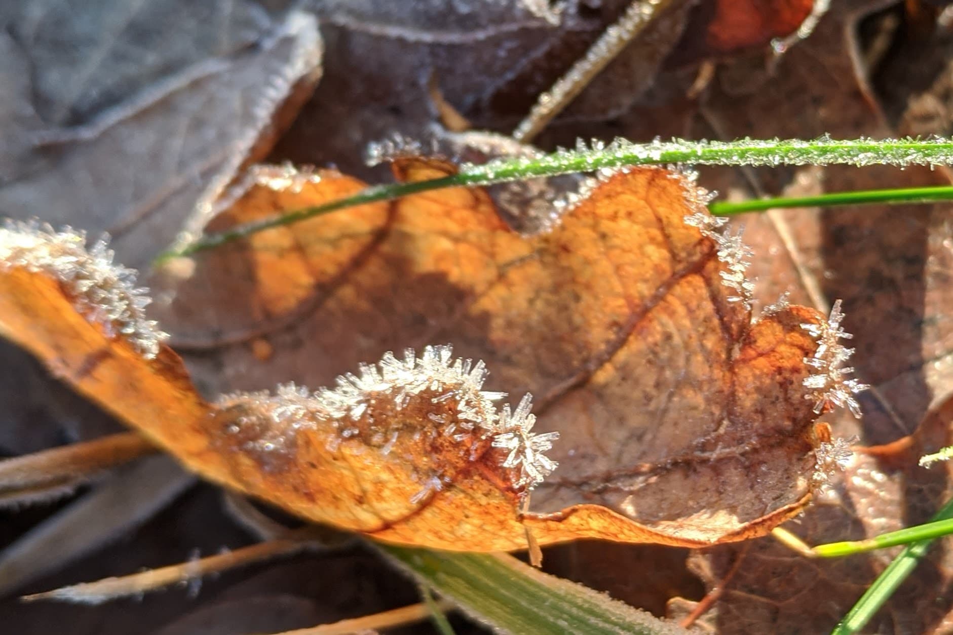
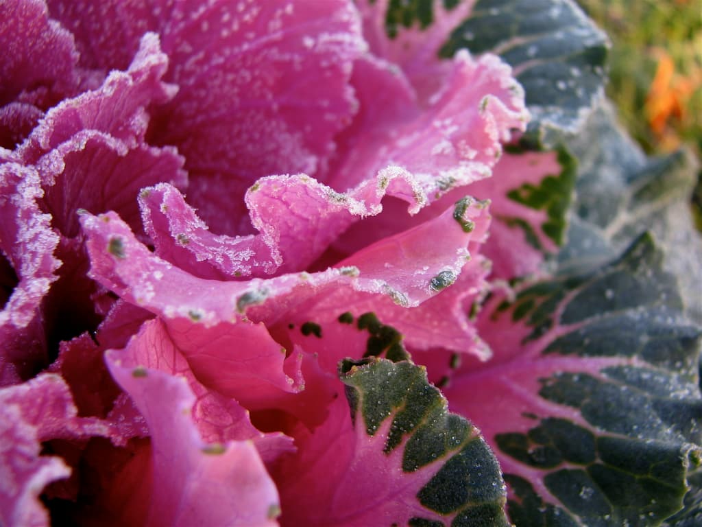
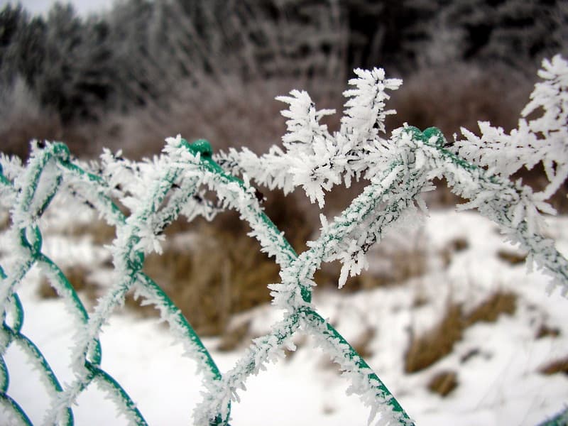
Frost advisory is the alert that confuses people most, because it often arrives when the forecast low is still above 32 degrees F. That is not a mistake. Frost forms on exposed surfaces, and those surfaces can radiate heat away faster than the standard air temperature measured several feet above the ground. On calm, clear nights, leaves, flower buds, and the tops of raised beds can cool into the danger zone even when the official low temperature bottoms out in the mid-30s.
This is why many forecast offices use a combination of temperature and setup conditions. NWS Caribou and NWS Raleigh both describe frost advisory criteria around 33 to 36 degrees F, but only when light winds and mostly clear skies support good radiational cooling. In other words, a windy 35 degree F night can be less of a frost problem than a calm 35 degree F night. That forecast nuance is also why it helps to pair the alert text with the local overnight hourly forecast instead of looking only at the single daily low.
Frost advisory also signals a narrower damage profile than a true freeze warning. Frost can burn blossoms, blacken new vegetable starts, and damage recently emerged foliage while leaving sturdier plants intact. A freeze warning is broader and more severe: it implies the air mass itself is cold enough to hold temperatures at or below freezing long enough to damage a much larger share of tender vegetation. NWS St. Louis summarizes the distinction well by noting that frost can happen with air temperatures at or below 36 degrees F, while a freeze is when temperatures actually fall to 32 degrees F or below, and a freeze can occur without visible frost.
Why does the growing season matter so much?
Frost and freeze alerts are damage-oriented products, not just thermometers with legal labels. That is why the growing season shows up in nearly every local criteria page. Offices typically start the program after the average last spring freeze and stop it after the first hard autumn freeze, when the most vulnerable seasonal vegetation has already been ended for the year. Outside that window, the forecast may still mention subfreezing temperatures, but a formal frost advisory or freeze warning may not be issued because the agricultural and garden impact picture has changed.
This is the part people miss when they compare screenshots from two states. One office may headline a late-March 31 degree F night because ornamental trees already budded out after a warm spell; another office may skip the same number because its growing season has not officially started or because surrounding areas are still dormant. NWS Houston, for example, notes that freeze products are often tied to the first freeze of the season and to spring periods when recent warmth has triggered green-up. That approach lines up with the real-world damage pattern rather than treating every calendar day the same.
For households, the takeaway is simple: do not assume “no alert” means “no risk” if you have already planted sensitive annuals early. Use local forecast temperatures and wind overnight, then layer on your own exposure. This is exactly the kind of gap where a broader household weather readiness checklist helps, because your risk can rise before the official plant-protection program starts.
“Growing season” is the reason alert products are local. It reflects when freeze damage is most operationally important, not a universal national date range.
What temperatures usually trigger a freeze warning or frost advisory?
Most public-facing explanations cluster around three numbers. Frost advisory lives in the 33 to 36 degrees F range, but only under light wind and clear-sky conditions that let exposed surfaces cool aggressively. Freeze warning usually starts at 32 degrees F or lower. Hard-freeze language often appears around 28 degrees F or colder, even though the separate hard-freeze watch and warning products were consolidated nationally in 2024. Those numbers are useful planning anchors, but they are not a substitute for reading the actual alert text because offices customize details around local climatology and impact patterns.
Several current NWS criteria pages show the variation clearly. NWS Caribou lists freeze warning at 32 degrees F or less during frost/freeze season and frost advisory at 33 to 36 degrees F with light wind and mostly clear skies. NWS Charleston, West Virginia says freeze warning is issued when minimum temperatures are expected to be 29 to 32 degrees F during the locally defined growing season, and it notes that hard-freeze wording is now folded into freeze watch or warning messaging. NWS Cleveland uses a simpler public description: freeze warning when temperatures will be at or below 32 degrees F over a large area for a significant time during the growing season.
What should you do with that information? Treat 36 degrees F as the point where radiational frost becomes worth monitoring, 32 degrees F as the action threshold for most tender plants and exposed water fixtures, and 28 degrees F or below as the range where damage becomes much more severe and repeated protection may fail. Then verify the local office criteria for your county, because that is the language the alert map, Wireless Emergency Alerts, and overnight update text will actually use.
What should you do when a freeze watch is issued?
A freeze watch is your cheap time. You still have enough runway to protect things efficiently instead of improvising in the dark. Start with the assets that take the most effort to secure: heavy pots that need a dolly, irrigation backflow preventers, hoses, exposed hose bibs, and any early-season vegetables that cannot simply be replaced. If a cold watch appears during a travel day or commute window, it is also the moment to revisit your winter car emergency kit checklist and make sure gloves, scraper, and charger are already in the vehicle.
The second step is to verify duration and wind. A quick dip to 31 degrees F at sunrise is a different problem from seven hours at 29 degrees F with gusty north wind. If you see the colder scenario building, move from "I should probably cover that" to "I need to protect anything I care about now." This is also when you should stop trusting generalized weather apps if the local alert text is more specific than the icon. Read the official statement and compare it with the hourly temperature line for your exact location.
- Bring in portable plants and hanging baskets before evening cooling starts.
- Locate covers that reach the ground and can trap soil heat instead of just touching leaves.
- Disconnect and drain hoses, then protect exposed outdoor faucets or above-ground pipe sections.
- Delay sprinkler schedules that could leave exposed hardware wet right before freezing temperatures arrive.
- Check whether pets, livestock water, and early-morning travel plans need cold-weather adjustments.
What should you do when a freeze warning is issued tonight?
Once a freeze warning is in effect, the emphasis shifts from staging to completion. NWS frost and freeze pages commonly recommend covering plants before sunset, moving sensitive containers indoors, and taking steps to protect unprotected outdoor plumbing. Ready.gov's winter weather guidance adds the bigger household layer: insulate or protect water lines where appropriate, know how your home heats vulnerable spaces, and prepare for a colder morning than the previous day may have suggested.
Garden protection should be realistic, not theatrical. Lightweight frost cloth, sheets, or blankets that extend to the ground work better than plastic touching the leaves, because the goal is to trap residual ground heat. If you only have a frost advisory or a short shallow freeze, that can be enough. If the warning includes lows in the upper 20s, repeated hours below freezing, or hard-freeze wording in the body text, assume some tender annuals and tropicals are still likely to take damage unless you move them fully indoors or into a heated shelter.
Plumbing risk depends on exposure, not just the alert name. The typical first casualties are exterior hose bibs, backflow preventers, hoses left attached to faucets, and above-ground irrigation components. If the freeze warning statement explicitly mentions damage to unprotected outdoor plumbing, treat that as a direct prompt to drain, wrap, or slow-drip vulnerable outdoor fixtures. Do not over-rotate and assume every interior pipe is about to burst from a one-night 31 degree F warning; instead focus first on the lines actually exposed to outdoor air.
If you need a concise execution order, use this one: protect plants, protect exposed plumbing, confirm heat and clothing for the morning, then check the pre-dawn hourly forecast one last time before bed. The site's what-to-wear tomorrow guide can help if the warning is paired with a sharp temperature rebound later in the day and you are dressing for both cold sunrise and milder afternoon conditions.
Are hard freeze watches and warnings still used?
As separate national products, no. NOAA and the National Weather Service simplified the cold-weather suite effective October 1, 2024. The national change renamed hard freeze watches to freeze watch and consolidated hard freeze warnings into freeze warning, with stronger wording inside the product body when forecasters need to emphasize a more destructive hard freeze. That means the modern forecast workflow is simpler on the map but still preserves the severity message in the text.
This matters for search behavior because plenty of people still look for "hard freeze warning" and wonder why the map now shows only "freeze warning." The answer is not that the threshold vanished. The threshold can still appear in office criteria and statement wording, especially around 28 degrees F or colder temperatures, but the separate headline product was removed to simplify the nationwide alert suite. If you are comparing older gardening articles to current NWS messages, this is one of the biggest terminology updates to remember.
In practice, read the body text for temperatures, duration, and impact wording instead of assuming the headline alone tells you whether the event is marginal or severe. That is the same discipline used in the site's winter briefing workflow: the map gets your attention, but the details that change decisions live in the supporting text.
Bottom line for tomorrow morning
If you only remember one thing, remember this: a freeze watch is a preparation signal, a freeze warning is an execution signal, and a frost advisory is a targeted damage signal for radiational cooling nights that may not look dangerous at first glance. The forecast number matters, but the message becomes much more useful when you read it together with local criteria, growing-season status, and the duration of cold in the final hours before sunrise.
That is also why the same alert can feel routine to one household and urgent to another. Someone with no garden and insulated indoor plumbing may only need a jacket for the morning commute. Someone with hanging baskets, early tomatoes, or exposed irrigation hardware may need to act before dark. Let the alert name tell you how fast to move, then let the overnight hourly forecast tell you how much protection is actually worth the effort.